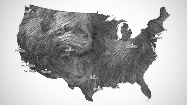
With their newly unveiled Wind Map, Fernanda Viégas and Martin Wattenberg use their impressive data visualization skills to create a real-time, flowing image of wind currents the United States. The pair, who are employed as co-directors of Google’s “Big Picture” visualization group in Cambridge, Massachusetts, are using the art project to promote wind power development.
“An invisible, ancient source of energy surrounds us,” they write, “energy that powered the first explorations of the world, and that may be a key to the future.”
Wind Map uses data from the National Digital Forecast Database to create the elegant, flowing map. Besides capturing the mercurial fluid mechanics of the wind, the zoomable map shows off the regional feasibility of wind power.
Very awesome.